Blog

  • Aplitop announces integration in the Railway Innovation Hub

    Aplitop announces integration in the Railway Innovation Hub

    Málaga, Spain. July 25, 2023 – Aplitop, developers of geospatial solutions and focused on making the user part of their team, is proud to announce its recent collaboration with the Railway Innovation Hub, the prestigious Spanish cluster recognized internationally for its innovation in the railway and technological fields.

    This integration is significant for Aplitop as it will strengthen its presence in the railway sector and help take its solutions to an even more advanced and specialized level, highlighting the following:

    πŸ—Ί Applications for Topography and Civil Engineering

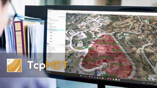
    We have a comprehensive software for all types of topography and civil engineering projects called TcpMDT, particularly effective in railway projects. It allows for alignment in plan, elevation, layout, creation of digital terrain models, contour lines, profiles, and volumes with maximum efficiency and precision.

    🌐 Point Cloud and Photogrammetry Applications

    Among the most notable solutions is Tcp PointCloud Editor, a leading software for managing point clouds and geospatial data. This innovative tool enables professionals in railway transportation to access and process data efficiently, optimizing decision-making and improving accuracy in each project.

    πŸš‡ Applications for Tunnels

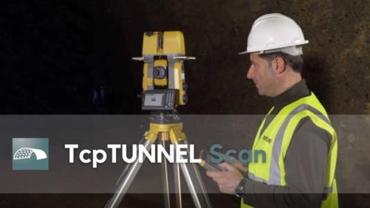
    Aplitop offers a complete set of solutions that simplify and streamline the control of railway tunnel projects. Using total stations or 3D scanners, these applications ensure precise planning and execution.

    With this collaboration, both entities aim to foster innovation and promote the development of cutting-edge railway projects, thus driving progress and efficiency in passenger and freight transportation.

    Useful links:

    πŸ”— Tcp PointCloud Editor Product Page πŸ‘‰ Go to the link

    πŸ”— Topographic Applications Page πŸ‘‰ Go to the link

    πŸ”— Tunnel Applications Page πŸ‘‰ Go to the link

    πŸ”— Official website of Railway Innovation Hub πŸ‘‰ Go to the link

  • TcpMDT for ZWCAD 2024

    TcpMDT for ZWCAD 2024

    From the Aplitop team, we announce the availability of TcpMDT for ZWCAD 2024, the combination of both tools will help you to take one step further the productivity of your surveying and civil engineering projects.

    For more information about ZWCAD 2024

    If you want to see all the changes in depth, click on the link below to access the product page.

    πŸ‘‰ ZWCAD 2024 Product Page

    For more information about TcpMDT

    If you are interested in TcpMDT and want to learn more, click on the following link to find out more.

    πŸ‘‰ TcpMDT Professional Product Page

    πŸ‘‰ Tcp PointCloud Editor Product Page

    πŸ‘‰ TcpMDT Datasheet for ZWCAD

    Videos

    πŸŽ₯ Tcp PointCloud Editor | LiDAR Point Cloud in ZWCAD 2024

    πŸŽ₯ Tcp PointCloud Editor | Generation of DTM from Point Cloud on ZWCAD 2024

    πŸŽ₯ Tcp PointCloud Editor | Drone Flight Point Cloud on ZWCAD 2024

    πŸŽ₯ Tcp PointCloud Editor | Point Cloud from Terrestrial Laser Scanner with ZWCAD 2024

    If you have any questions about the powerful combination between ZWCAD 2024 and our applications, please click here πŸ‘‰ Contact us

  • TcpTunnel Scan on Topcon FT-100

    TcpTunnel Scan on Topcon FT-100

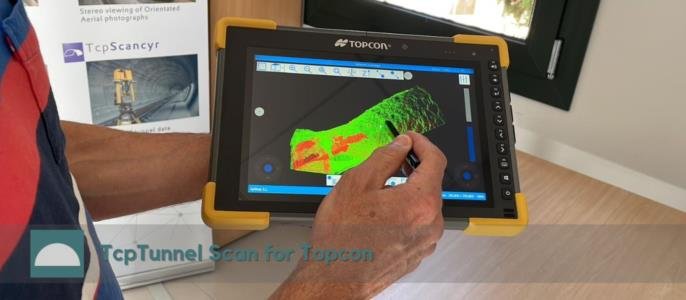
    From the Aplitop team, we announce the compatibility of the software with Topcon FT-100 tablets.

    It increases the speed of visualization of the point cloud and tunnel profiles, everything on site and without stopping by the office.

    If you want to know more, visit the TcpTunnel Scan product page.

  • New version 1.7 of Tcp PointCloud Editor

    New version 1.7 of Tcp PointCloud Editor

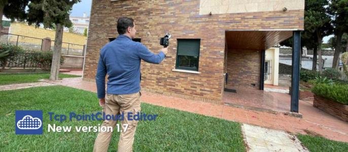
    From the Aplitop team, we announce the new version 1.7 of Tcp PointCloud Editor.

    What are the latest features?

    πŸ†• New quick profile viewer with real-time point selection and classification πŸ‘‰ Video

    πŸ†• New CAD functions for entity editing and drawing of arcs, circles and 3D faces πŸ‘‰ Video

    πŸ†• Coordinate information and view centering on 3D models

    What new enhancements have been implemented?

    βœ… Export of points and meshes to 3D PDFs

    βœ… Import of large point clouds

    βœ… Import and export of IFC 4.3 files

    For more information, you can access the change history document.

    Resources

    πŸ‘‰ Product Page

    πŸ‘‰ Playlist

    πŸ‘‰ Request a Quote

    πŸ‘‰ Free Trial

  • TcpMDT for AutoCAD 2024

    TcpMDT for AutoCAD 2024

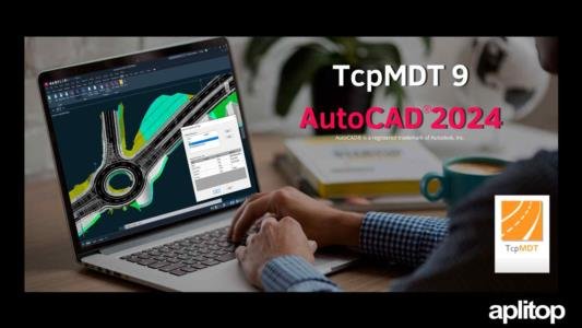
    The new version of MDT 9 for AutoCAD® 2024 is now available.

    The combination of TcpMDT with this software will help you to improve the performance of your surveying projects.

    Support for AutoCAD 2024 is free for all users with current maintenance and can be upgraded through the application itself (provided the user is logged in).

    For more information about AutoCAD 24

    For more information about TcpMDT

  • New update 2.5 of TcpGPS for Androidβ„’

    New update 2.5 of TcpGPS for Androidβ„’

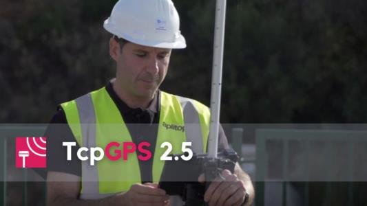
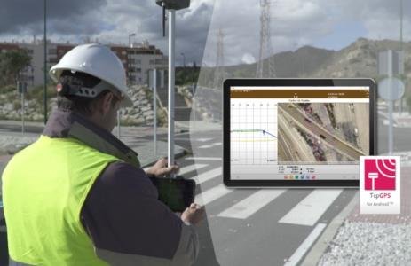
    From the Aplitop team, we announce a new update for TcpGPS for Android™.

    What's new in version 2.5?

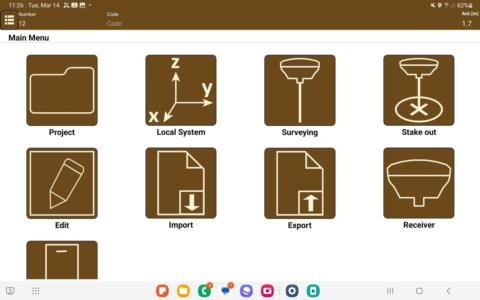
    πŸ†• Possibility to choose between the new icon menus and the side menu.

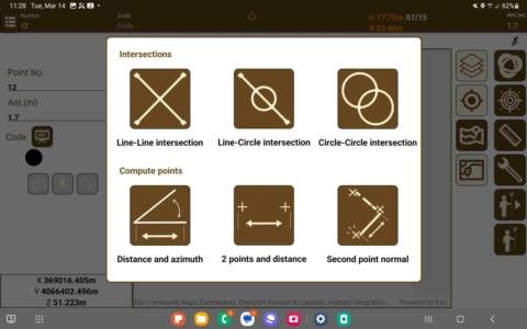
    πŸ†• New methods for taking inaccessible points.

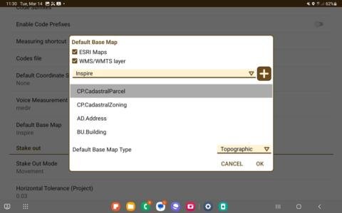
    πŸ†• Choice of default coordinate system and basemap.

    What new enhancements have been implemented?

    βœ… New generic NMEA driver for Bluetooth LE connection

    βœ… Ability to use WMS and WMTS services in basemaps

    βœ…Improvements in the creation of coordinate systems

    For more information, you can access the change history document.

    *This version will be automatically installed on the device if you have enabled the "Automatically update applications" option in Google PlayStore.

  • TcpMDT9 for GStarCAD 2023

    TcpMDT9 for GStarCAD 2023

    TcpMDT9 version for GStarCAD 2023 is now available.

    From today, users can enjoy this complete, economical and powerful alternative to develop new projects in CAD environment.

    TcpMDT is the most complete and accessible application for surveyors and civil engineers, with it you can design from small plots to more ambitious projects such as highways and large housing developments.

    Integration is available for both actively maintained users and newly acquired licenses.

    Resources:

    πŸ‘‰ TcpMDT9 product page

    πŸ‘‰ TcpMDT9 Playlist

    πŸ‘‰ GStarCAD 2023 Product Page

  • News and changes in TcpMDT 9

    News and changes in TcpMDT 9

    From the Aplitop team, we announce a series of new features, fixes and improvements.

    What are the latest features?

    πŸ†• In the export to KML for Google Earth, texts are now included and you can decide whether the altitudes are absolute or glued to the ground. (Vídeo)

    πŸ†• Direct export to PDF format from the profile editors.

    πŸ†• Section editor allows to update the segment and to continue working in the CAD

    πŸ†• New command to send current project information and files.

    πŸ†• When importing shapefiles you can select the source and destination systems, reprojecting if necessary.

    What new enhancements have been implemented?

    βœ… It is now possible to assign different diameters to a pipe section (add to video library).

    βœ… In the calculation of volumes by mesh difference it is now possible to compare files with different cell size.

    βœ… Separation of platforms, ditches and slopes in the Hexagon XML export of the selected instrument.

    For more information, you can access the change history document.

  • New version of TcpTunnel Scan

    New version of TcpTunnel Scan

    From the Aplitop team, we announce a new update for TcpTunnel Scan.

    In this one, the following new features are included to further improve productivity in the control of tunnel project works, with the robotic total station TOPCON GTL-1200:

    βœ… Point cloud and project download via WiFi πŸ‘‰ watch video

    βœ… Super fine scanning possible

    βœ… Configuration options dependent on the selected instrument

    If you want to know more, visit the TcpTunnel Scan product page.

  • New update 2.4 of TcpGPS for Androidβ„’

    New update 2.4 of TcpGPS for Androidβ„’

    Announcing a new update for TcpGPS for Android™.

    What's new in version 2.4?

    – Import of surface, alignment and profile files in IFC4x3 format βœ…

    – Issue management according to the BIM Collaboration Format (BCF) standard βœ…

    – Enhanced compatibility with Android 12 and its new permissions βœ…

    Additional resources:

    πŸ‘‰ Change history document

    πŸ‘‰ Frequently asked questions and answers

    πŸ‘‰ TcpGPS for Android™ on GooglePlay