Blog

  • New update 2.9 of TcpGPS for Android

    New update 2.9 of TcpGPS for Android

    From the Aplitop team, we announce a new update for TcpGPS for Android™.

    What's new in version 2.9?

    πŸ†• New module for geodesy and creation of CRSs πŸ‘‰ Video

    πŸ†• New CAD tool to segregate and join parcels/polygons πŸ‘‰ Video

    πŸ†• Much faster loading of graphic layers

    For more information, you can access the change history document.

  • Corsica2000: A Success Story with TcpGPS by Aplitop

    Corsica2000: A Success Story with TcpGPS by Aplitop

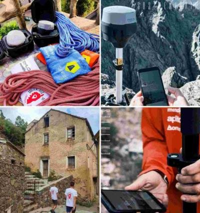
    We are excited to share a remarkable success story to celebrate our 20th anniversary at 2000 meters with our land surveying application TcpGPS for Android™.

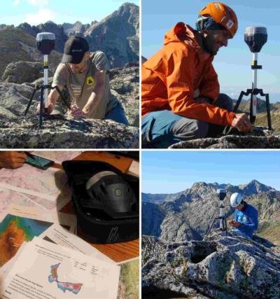
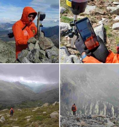
    This summer, the intrepid group of professional surveyors and mountaineers known as Sostemetries embarked on an adventurous journey to unveil the secrets of the rough island of Corsica (France).

    The exploration has been divided into 2 mountain stages, one in August and the other in October. Both have just concluded after several days of measurements in rough terrain. Now, the team is eager to begin the post-processing to see the results of this amazing project. project.

    We extend our heartfelt gratitude to the dedicated team at Sostemetries for their unwavering commitment to merging the realms of land surveying, sports, and adventure. Additionally, we sincerely thank Emlid and Mendilur for providing top-of-the-line precision equipment, which, in conjunction with our application, ensured a seamless and fruitful exploration process.

    Useful links:

    TcpGPS for Android™ product page

    About Sostremetries

    About Mendilur

    About Emlid

  • Discover Aplitop TcpGPS with Leica Geosystems FLX100 Plus

    Discover Aplitop TcpGPS with Leica Geosystems FLX100 Plus

    Aplitop and Leica Geosystems are working together to provide a complete solution for land surveying projects.

    Our application is a high-precision tool designed for surveying professionals. It facilitates data collection and stakeout of plots, urban areas and infrastructure.

    When combined with the Leica Geosystems FLX100 Plus, it becomes an even more powerful solution that will allow you to obtain accurate data for your measurements and improve the performance of your surveying work.

    Additional information about TcpGPS:

    βšͺ World coverage base maps and projections.

    βšͺ Ability to use map web services or CAD and GIS files as user layers.

    βšͺ Simple and accurate survey with point, linear, and polygonal object capture.

    βšͺ Linking of photographs, voice memos, and user attributes.

    βšͺ Stakeout of points, lines, or polylines with voice guidance.

    βšͺ Data export to the cloud in multiple formats.

    βšͺ Optional module for working with surfaces, roads, and BIM projects.

    Check the post in Leica Geosystems LinkedIn Profile: Link
  • TcpMDT for GStarCAD 2025

    TcpMDT for GStarCAD 2025

    From the Aplitop team, we want to inform you that the latest version of TcpMDT 9 for GStarCAD 2025 is now available.

    It takes performance to a new level with hardware acceleration and other enhancements, significantly improving the design experience. Exciting new features include Parametric Constraints, BIM Data Editing, and Voice Annotation, which further enrich functionality. In addition, Python support has been extended, allowing for more robust customization and automation.

    You will be able to complement and enhance these features with the functionality of TcpMDT, the most complete and accessible application for professionals in the industry. With it, you can work on all types of projects, from small plots of land to roads and housing developments.

    The integration is available both for users with active maintenance and newly acquired licenses, as well as a series of links of interest:

    πŸ”— TcpMDT9 Product Page

    πŸ”— TcpMDT9 Playlist

    πŸ”— GStarCAD 2025 Product Page

    πŸ”— GStarCAD 2025 Presentation Video

  • Discover the new version 1.2 of TcpMDT Photovoltaic

    Discover the new version 1.2 of TcpMDT Photovoltaic

    We are pleased to announce the new version 1.2 of TcpMDT Photovoltaic.

    Aplitop, following its philosophy, offers a tool that makes profitable the most complex terrains and helps design photovoltaic plants and decision-making at a key stage: optimizing and accurately calculating earthworks.

    Highlighted features

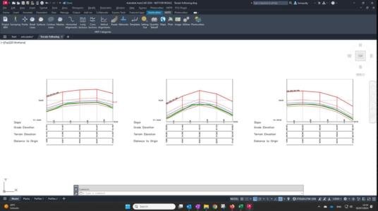
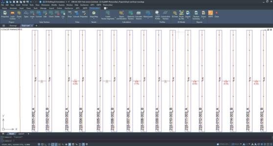
    πŸ†• Support for dual-row trackers

    πŸ†• Support for terrain following trackers

    πŸ†• New joints reports

    You can see the rest of the news and changes in the change history document.

    Want to learn more?

    If you would like to learn more about this new version, here are some useful links:

    πŸ”— Request TcpMDT PV quotation

    πŸ”— Request a demo of TcpMDT PV

    πŸ”— Discover the TcpMDT PV page

  • Tcp PointCloud Editor in DJI Enterprise Ecosystem

    Tcp PointCloud Editor in DJI Enterprise Ecosystem

    From Aplitop, we are proud to share with you that our Tcp PointCloud Editor has been integrated into the DJI Enterprise solutions ecosystem, providing a comprehensive and versatile software for advanced point cloud management.

    The presence of our application in the ‘Geospatial Software’ section of the DJI ecosystem highlights the synergy and added value that Aplitop offers to drone users and DJI technologies. The ability to process data from drones and other mobile devices establishes the Tcp PointCloud Editor as an essential solution for surveying and geospatial analysis projects.

    Below, we share the link to the official DJI page so you can discover more about the application:

    πŸ”΅ Tcp PointCloud Editor in the DJI Solutions Ecosystem

  • New update 2.8 of TcpGPS for Androidβ„’

    New update 2.8 of TcpGPS for Androidβ„’

    From the Aplitop team, we announce a new update for TcpGPS for Android™.

    What's new in version 2.8?

    πŸ†• Drawing lines and polygons by joining points graphically. πŸ‘‰ Video

    πŸ†• Creation of local systems by parameters. πŸ‘‰ Video

    πŸ†• Calculation of volumes of cut and fill (professional version). πŸ‘‰ Video

    For more information, you can access the change history document.

  • TcpMDT for ZWCAD 2025

    TcpMDT for ZWCAD 2025

    From the Aplitop team, we announce the availability of TcpMDT for ZWCAD 2025, the combination of both tools will help you to take one step further in the productivity of your surveying and civil engineering projects.

    For more information about ZWCAD 2025

    If you want to see all the changes in depth, click on the link below to access the product page.

    πŸ‘‰ ZWCAD 2025 Product Page

    For more information about TcpMDT

    If you are interested in TcpMDT and want to learn more, click on the following link to find out more.

    πŸ‘‰ TcpMDT Professional Product Page

    πŸ‘‰ TcpMDT Datasheet for ZWCAD

    If you have any questions about the powerful combination between ZWCAD 2025 and our applications, please click here πŸ‘‰ Contact us

  • TcpMDT for AutoCAD 2025

    TcpMDT for AutoCAD 2025

    The latest version of TcpMDT 9 is compatible with AutoCAD® 2025.

    Exploring this combination will help you enhance the performance of your land surveying projects.

    The compatibility with AutoCAD 2025 is free for users with an active maintenance agreement, and it can be updated directly in the app (though the user must be registered in the private area of our website).

    Check more information about AutoCAD 2025

    Check more information about TcpMDT 9

  • TcpGPS for Androidβ„’ Compatible with ArduSimlpe

    TcpGPS for Androidβ„’ Compatible with ArduSimlpe

    From the Aplitop team, we are pleased to announce our collaboration with ArduSimple.

    Together, we have been working to empower surveyors by seamlessly integrating our TcpGPS for Android™ field surveying application with ArduSimple receivers, including the RTK Calibrated Surveyor Kit model.

    To learn more about this exciting collaboration, we invite you to explore the links below:

    πŸ‘‰ TcpGPS for Android™ Product Page

    πŸ‘‰ TcpGPS for Android™ with ArduSimple Promotional Video

    πŸ‘‰ TcpGPS for Android™ Configuration with ArduSimple

    πŸ‘‰ Ardusimple Oficial Website