Blog

  • New Version of Tcp PointCloud Editor v1.21

    New Version of Tcp PointCloud Editor v1.21

    New Version of Tcp PointCloud Editor: More Power for Point Cloud Processing and SLAM Scanning

    Aplitop announces a new update for tcpPointCloud Editor, its advanced solution for point cloud processing, laser scanning, and SLAM data management. This release introduces new AI-based functionalities, performance improvements, and enhanced compatibility with 3D capture devices and technologies.

    This new version further strengthens Point Cloud Editor as a professional tool for surveying, engineering, construction, and digital environment modeling, enabling users to work more efficiently with large volumes of LiDAR data, panoramic images, and SLAM trajectories.

    What are the latest features and improvements?

    Below is a selection of the main new features included in tcpPoint Cloud Editor v1.21:

    🆕 Automatic project saving after creating or importing elements and when closing the project, without user intervention

    🆕 New AI-based automatic classification model for power line detection in high-density, non-urban point clouds (beta)

    🆕 Quick profile generation from lines and 2D/3D polylines

    🆕 Improvements in panoramic image management

    🆕 User interface now available in German and Italian

    For more information, you can consult the change history document.

    Productivity and Advanced Editing Improvements

    The update also introduces new tools designed to streamline daily workflows involving profiles, CAD editing, and topographic data processing.

    Among the most significant improvements are:

    • Quick profiles from lines and 2D/3D polylines
    • Expanded Raster Editor with new drawing and editing tools
    • Improved layer and reference management
    • Optimized import and processing of panoramic images
    • Automatic project saving
    • Improvements in longitudinal profiles and coplanar sections

    These features help optimize analysis, vectorization and editing tasks on point clouds and 3D models, improving workflow efficiency for complex surveying and civil engineering projects.

    Professional Software for Point Clouds, LiDAR, and BIM

    tcpPointCloud Editor is designed for professionals working with:

    • LiDAR point clouds
    • Terrestrial and mobile laser scanning
    • SLAM systems
    • BIM and IFC models
    • 3D surveying
    • Civil engineering and construction

    The application provides advanced visualization, classification, editing, and export tools, integrating seamlessly with CAD environments and modern geospatial workflows.

    Useful Links

    🔗 TcpPointCloud Editor Product Page

    🔗 Request a Quote for TcpPointCloud Editor

    🔗 Download the TcpPointCloud Editor Demo

    Users with an active maintenance contract can download the update from the Aplitop Private Area.

  • New update available: tcpGPS for Android now compatible with Android 16

    New update available: tcpGPS for Android now compatible with Android 16

    Android 16 is now available on the latest devices, and at Aplitop  we continue working to guarantee maximum compatibility and performance for our surveying and GNSS positioning solutions. 

    We are announcing the release of a new update of tcpGPS for Android, which incorporates full compatibility with Android 16 to ensure the correct functioning of the application on the latest generation mobile devices used in fieldwork. 

    This update allows surveying, engineering and civil construction professionals to continue working with total stability and precision using GNSS receivers and high-precision positioning services in the Android environment. 

    Main improvements in the new version of tcpGPS for Android 

    The new update of tcpGPS for Android includes: 

    –  Optimized compatibility with Android 16 

    –  Improved stability and performance on recent Android devices 

    –  Greater reliability in connections with GNSS receivers 

    –  Optimization for surveying and fieldwork tasks 

    –  Enhanced user experience in stakeout and data capture tasks 

    For more information, you can access the changelog document

    Automatic update via Google Play 

    Users who already have the application installed will receive the update automatically through Google Play, with no additional action required. 

    What is tcpGPS for Android? Professional surveying and GNSS software 

    tcpGPS for Android is a solution developed for professionals who need to carry out surveying work on Android devices connected to high-precision GNSS receivers. 

    The application allows you to work efficiently on tasks such as: 

    –  Topographic surveys 

    –  On-site stakeouts 

    –  Ability to use web map services or CAD and GIS files as user layers. 

    –  Data export to the cloud in multiple formats. 

    –  Integration with surveying equipment and GPS/GNSS receivers 

    More information about tcpGPS for Android 

    If you would like more information about this new update or to discover all the software features, you can access the following links: 

    ➡️ Request a quote for tcpGPS for Android 

    ➡️ Request a demo of tcpGPS for Android 

    ➡️ Official tcpGPS for Android page 

  • tcpMDT 25 Updates Its Compatibility with GstarCAD 2026 SP3

    tcpMDT 25 Updates Its Compatibility with GstarCAD 2026 SP3

    Aplitop announces the availability of a tcpMDT 25 update compatible with GstarCAD 2026 SP3, aimed at users working with this CAD platform on surveying, civil engineering, and construction projects.

    This update enables tcpMDT 25 to be used with GstarCAD 2026 SP3, maintaining the software’s usual workflows for tasks such as point management, digital terrain modelling, contour line generation, longitudinal and cross-section profiles, volume calculations, alignment design, setting out, and preparation of technical documentation.

    Compatibility with GstarCAD 2026 SP3 is part of Aplitop’s commitment to keeping its solutions up to date with supported CAD platforms, allowing professionals to use recent versions of their working environment without disrupting project continuity.

    Users can download GstarCAD 2026 SP3 from the official GstarCAD website and obtain the tcpMDT 25 update from the Aplitop Private Area.

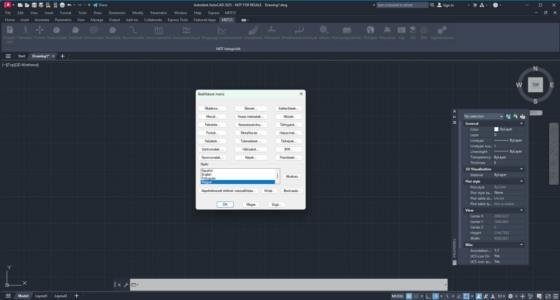
  • tcpMDT 25 for AutoCAD® 2027

    tcpMDT 25 for AutoCAD® 2027

    The new version of MDT 25 for AutoCAD® 2027 is now available. Combining tcpMDT with this software will help you improve the performance of your surveying projects.

    Support for AutoCAD® 2027 is free for all users with a current maintenance contract.

    Links of interest

    🔗 tcpMDT 25 Change History

    🔗 What's New in AutoCAD® 2027

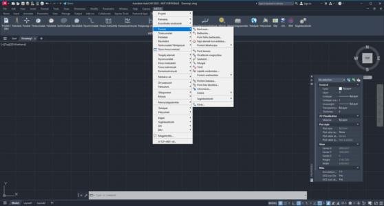
  • tcpMDT 25 Available in Polish

    tcpMDT 25 Available in Polish

    We are pleased to announce that the new version of tcpMDT 25 is now available with a Polish interface thanks to our distributor Szansa.

    With tcpMDT 25 in Polish, you will be able to take full advantage of all the new features of the release and its different modules.

    Useful links:

    Download the demo

    Request a quote

  • tcpMDT Photovoltaic: Compatibility with Fixed Table

    tcpMDT Photovoltaic: Compatibility with Fixed Table

    What is tcpMDT Photovoltaic?

    TcpMDT PV is a software that runs as a complement to CAD applications, allowing the minimization of land movement, as well as the realization of measurements and the staking out of solar trackers. Aplitop, true to its philosophy, offers this tool to monetize the most complex land and assist in the design of photovoltaic plants.

    In addition, it facilitates decision-making at a crucial stage: the optimization and accurate calculation of earthworks.

    Highlighted features

    Version 2.0 includes a series of new features, among which the following stand out:

    🆕 Compatibility with fixed tables. Watch video

    🆕 Export to PVSyst®. Watch video

    You can learn about the rest of the new features and changes in the change history document.

    Want to learn more?

    If you want to learn more about this new version, below, we share a series of links of interest:

    🔗 Request TcpMDT PV quotation

    🔗 Request a demo of TcpMDT PV

    🔗 Discover the TcpMDT PV page

  • tcpMDT-Revit integration: How to Carry a digital model with real coordinates

    tcpMDT-Revit integration: How to Carry a digital model with real coordinates

    If you prefer, you can read the article in PDF here: tcpMDT-Revit integration: how to carry a digital model with real coordinates.

    By Francisco Navarrete Mandly 

    Bringing a digital terrain model (DTM) from a CAD/topographic environment to Revit is an increasingly common step to define the grading where a building will be supported, develop and coordinate the layout of roads and the urbanization of the site, obtain measurements, improve 3D visualization, check for clashes and deliver an IFC to third parties. 

    The challenge is that Revit handles the site and geometric references with a different logic than a traditional CAD flow, and that directly affects origins, base points, shared coordinates, precision limits, and the final result. 

    1. Need for this exchange and difficulty in choosing the right alternative  

    Integrating a terrain created in tcpMDT into Revit seems, a priori, a "simple" operation: export and import. In practice, the real difficulty lies in the number of possible combinations and in the fact that each decision (format, geometric content, whether to import or link, how to position and how to solve coordinates) changes the behavior of the model. 

    1.1. Alternatives and Additional Licenses 

    For years, LandXML-based streams for exchanging survey data (often using plug-ins) existed in certain Revit environments and versions, but they have not always been available or consistent across versions. In parallel, many "classic" land-BIM integration flows are supported by other Autodesk applications such as Civil 3D or specific extensions. 

    Precisely for this reason, a key advantage of this article is that it summarizes two practical workflows that do not require additional licenses to perform the basic exchange (beyond tcpMDT and Revit), avoiding relying on external tools to obtain usable terrain in Revit. 

    1.2. CAD or IFC 

    🔹 CAD option (DWG/DXF): Here you must choose which representation is exported from tcpMDT and with which objective in Revit. In CAD, terrain can be represented as a point cloud, 3D faces, polyface meshes, or contour lines. 

    🔹 IFC option: if the objective is BIM interoperability, the IFC provides structure and traceability, but also opens up another range of decisions: IFC 2×3, IFC 4 and IFC 4.3. And again, the critical question arises: how Revit will interpret the location and coordinates of the IFC. 

    1.3. Import or Link 

    🔹 Linking is usually the safest option for coordination (updates, link download, phased control). 

    🔹 Importing can "consolidate" geometry within the RVT, but it can also make the update flow more rigid. 

    1.4. Coordinate systems 

    In real coordination there are many variants: automatic positioning (by center, by origin, by shared coordinates if they exist) and manual positioning (consciously placing and adjusting).  

    Here a recurring problem appears: if the original file is in global coordinates (UTM/ETRS, etc.) and arrives in Revit "as is", it is very common for incidents to arise (huge distances from the Internal Origin, precision difficulties and strange graphic behavior).  

    2. Proven exchange flows 

    The following describes two reproducible workflows for bringing a terrain model from tcpMDT to Revit. Each one indicates the typical objective, the steps and the critical points that usually cause incidents. 

    2.1. CAD Drawing with 3D Faces 

    This flow is recommended when you want to convert the terrain into a native Revit element (toposolid) to work with the site, visualization and coordination in a direct and controlled way.  

    🔹 In tcpMDT, draw the surface as 3D faces and save the drawing. 

    🔹 In Revit, create a project and Link CAD to the DWG file. The example uses units in automatic and source-to-internal positioning. 

    🔹 Go to Massing & Site → Toposolid → Create from Import. On the Modify menurun Create a Toposolid from Import, and choose Create from CAD to get the solid. 

    Figure 1. MDT Surface converted to Toposolid in Revit 

    Video 1: tcpMDT to Revit Surface (link) 

    2.2. IFC File  

    This flow is especially suitable when the exchange has a clear BIM objective (delivery, coordination or federation) and you want to convert the terrain to a standard format, while maintaining georeferencing in a controlled way. 

    🔹 In tcpMDT, set the coordinate system of the project.  

    🔹 When exporting, indicate a reference point of known coordinates and enable the Draw Reference Point optionSelect the IFC version 4.3 Add2

    🔹 In Revit, link the IFC (Insert → Link IFC) to maintain an updatable and coordinating flow. 

    🔹 Place the IFC with an explicit criterion (e.g., IFC Origin to Project Base Point) and visually check the position using the exported point. 

    🔹 Check the units of the project and make sure to work in meters before setting coordinates, to avoid scale inconsistencies. 

    🔹 Set the actual coordinates: Manage → Coordinates → Specify coordinates at point, select the reference point, and enter its XYZ values. 

    🔹 Check the result by placing a point coordinate annotation/elevation and review properties to confirm that coordinates and orientation are consistent. 

    🔹 Maintain the IFC as a link: If IFC reviews are received, it must be reloaded and validated again against the same benchmark. 

    Figure 2. MDT Surface converted to Revit using an IFC file, in real coordinates 

    Video 2: IFC generated with tcpMDT to Revit (link) 

    3. Coordinate Origin 

    In Revit, the model's location is articulated around three complementary references: Internal Origin, Project Base Point, and Survey Point. When you create a new model, the Project Base Point and the Survey Point default to the Internal Origin.  

    3.1 Internal origin 

    The Internal Origin is the "fixed" reference of the model. Revit works on a modeling work area of 20 miles (32 km) in diameter; therefore, all model geometry (including links and imports) must be within a 10-mile (16 km) radius of the Internal Origin. If this limit is exceeded, the graphical representation may be less reliable and accurate.  

    3.2 Project Base Point 

    The Project Base Point establishes a baseline for measuring distances and placing objects in the context of the model. When starting a project, it is recommended to decide where to place it and agree on it as a team so that everyone works with the same reference point. 

    3.3 Survey Point 

    The Survey Point defines the origin of the coordinate system and provides real-world context (for example, a corner of the site or the intersection of two boundaries). In addition, when importing or linking models, it can be used as a reference for alignment along with the concept of shared coordinates.  

    3.4 Project North and True North 

    It is convenient to distinguish Project North/True North because it affects the orientation of views and the reading of coordinates", supported by the best practices of coordinates in Revit. 

    4. Conclusions and recommendations 

    If you need a native and editable terrain within Revit (Toposolid) to work on the site and coordination, the most direct option is the CAD flow using 3D faces, since Revit allows you to generate a Toposolid from imported CAD data/linked with 3D information.  

    On the other hand, if the priority is BIM interoperability and delivery or coordination in IFC with verifiable georeferencing, the most robust is the IFC flow supported by a reference point exported from tcpMDT.  

    Finally, it is recommended to document (in a coordination note) units, reference system, control point and positioning option used, so that each terrain update can be recharged without surprises. 

    References 

    tcpMDT Professional Product Page 

    tcpMDT OpenBIM Features 

    BIM for Surveyors 

    IFC Road Project 

    ROADBIM Project
  • tcp PointCloud Editor: Digitization of Facades and New Image Viewer

    tcp PointCloud Editor: Digitization of Facades and New Image Viewer

    What is Tcp PointCloud Editor?

    tcp PointCloud Editor is an AI-powered point cloud software for surveying, engineering, architecture, and design. It enables 3D modeling and processing point clouds from fixed or SLAM scanners, LiDAR, photogrammetry, and mobile applications.

    What are the latest software updates and enhancements?

    🆕 Import image tours from GoSLAM, Share, and XGrids scanners.

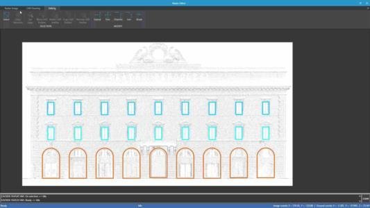
    🆕 An expanded raster editor that includes facade digitization, more entities, references, editing commands, and more.

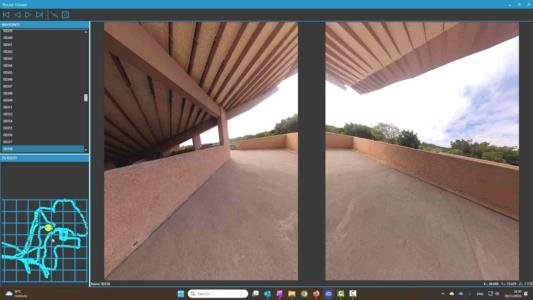
    🆕 A panoramic image viewer with buttons to switch images while maintaining orientation.

    🆕 Changes to the image route viewer user interface improve usability.

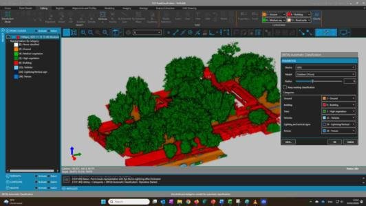
    🆕 Radius setting and error handling in automatic classification using AI.

    For more information, please refer to the change history document.

    Useful links

    🎥 Video – tcp PointCloud Editor | Image Tour

    🎥 Video – tcp PointCloud Editor | Digitization of Facades

    🔗 tcp PointCloud Editor Playlist

    🔗 Request a Quote for tcp PointCloud Editor

    🔗 Download the Demo of tcp PointCloud Editor

  • tcpMDT 25 Available in Hungarian

    tcpMDT 25 Available in Hungarian

    We are pleased to announce that the new version of tcpMDT V25 is available with a Hungarian interface, thanks to the work of our distributor CAD-design Kft.

    With tcpMDT 25 in Hungarian, you will be able to take full advantage of all the new features of the version and its different modules.

    Links of interest:

    Download the demo

    Request a quote

  • The Pyrenean3000ers: A Success Story of Aplitop's tcp PointCloud Editor in Collaboration with Sostremetries

    The Pyrenean3000ers: A Success Story of Aplitop's tcp PointCloud Editor in Collaboration with Sostremetries

    What Is the Success Story "The Pyrenean 3000ers" About?

    This summer, our friends at Sostremetries return to the Pyrenees after their successful surveying campaign on the island of Corsica, where they compiled a list of peaks over 2,000 meters above sea level (see previous case: LiDAR Identification of Mountain Peaks in Corsica, France).

    Now, their aim is nothing less than to scan over 55,000 km² of the Pyrenees to compile the most accurate and rigorous list possible of the three-thousanders that meet the topographic criteria.

    This ambitious project has been in the works for months, carried out with meticulous detail using tools such as tcp PointCloud Editor. Due to its scope, the fieldwork phase has been divided into two stages, to be carried out during the summer and autumn seasons of 2025 and 2026. During these campaigns, peaks and mountain passes requiring on-site verification will be measured.

    2026 campaign: mention in National Geographic Spain

    The project begins the year with an article in National Geographic Spain magazine which explains how the Aragonese Pyrenees have lost two of their iconic three thousand meter peaks following new, more accurate topographic measurements carried out by the Sostremetries team. After reviewing the altitude of several peaks, it was determined that two peaks previously considered to be over 3,000 m are actually below that height when strict criteria of height and prominence are applied. The article reflects how these changes demonstrate the modernization of cartography and the effort to establish a definitive list of Pyrenean peaks that meet current standards. This milestone undoubtedly marks a new stage in the project.

    You can read the full article here: 🔗 Changes in the list of peaks in the Pyrenees: two mountains are no longer three thousand meters high

    2025 Campaign: June–November

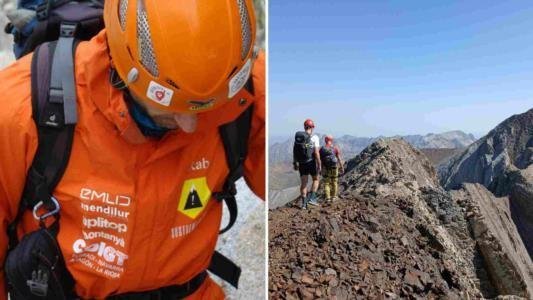
    The Sostremetries team conducted the first joint ascent with surveyors from across the country, providing a firsthand, on-site introduction to the “The Pyrenean 3000ers” project. The project’s ultimate goal was to compile an accurate and precise list of all peaks above 3,000 meters across the Pyrenees. During this first technical day, the focus was on the Vallibierna and Culebras peaks, separated by the legendary Paso de Caballo. Thanks to prior work using the tcp PointCloud Editor software, the team was able to pinpoint the exact location that determines Culebras Peak’s prominence and verify whether it met the essential 10-meter criterion to be included in the final list.

    The following field sessions continued with a clear objective: updating the list of the Pyrenean three-thousanders. Along the way, some conclusions emerged: Pico Maldito (the fourth highest peak in the Pyrenees to date) and Tuca de Culebras do not meet the prominence criterion and are therefore excluded from the Pyrenean three-thousanders list. However, after analyzing the data, two previously unknown summits were identified and added to the new list (though one of them still lacks an official name).

    Our tcp PointCloud Editor software assisted the surveyors at these critical moments with the following tools:

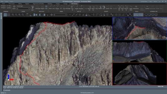
    🔵 CAD drawing tools: Allowed the import of tracks and waypoints (e.g., from Wikiloc) and visualizing them over the point cloud, which helped quickly identify the exact location of unnamed new summits that had never been climbed.
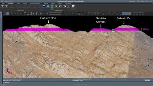
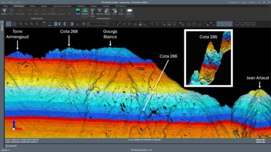
    🔵 Elevation selection tool: Enabled dynamic visualization of a constant altitude range to simulate fixed prominence. This served as a visual confirmation of whether the analyzed summit met the 10-meter prominence criterion to qualify as a three-thousander.
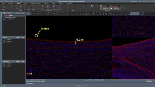
    🔵 Eye Dome Lighting (E.D.L.) function: Assisted in interpreting terrain, especially when the point cloud’s colorization was hypsometric or when the simultaneous RGB data was poorly lit—a common issue with airborne LiDAR on the northern slope. It also allowed visual detection of high points above the surrounding terrain. The team used it for final noise cleanup. EDL also helps identify bivouacs, artificial stone cairns, mid-wall needles, and even trails.
    🔵 RGB visualization mode: By displaying the colored point cloud, it allowed the detection of snow presence. If snow appeared on a saddle or summit, it alerted the surveyors that blindly relying on LiDAR could lead to overestimating the corresponding elevation.
    🔵 Surface triangulation and point cloud comparison: This feature was used to avoid discrepancies caused by snow cover or data from different sources (e.g., different countries with varying sea-level references).

    This is a summary of what the team has accomplished with our tool during the technical field sessions.

    What is tcp PointCloud Editor?
    tcp PointCloud Editor is an AI-powered point cloud software designed for surveying, engineering, architecture, and design. It enables 3D modeling and processing of point clouds from terrestrial or SLAM scanners, LiDAR, photogrammetry, and mobile applications.

    Links of Interest

    🔗 Official Sostremetries website

    🔗 tcp PointCloud Editor Product Page

    🔗 The COIGT delegation for Aragon, the Basque Country, La Rioja, and Navarre is sponsoring the 2025/2026 campaign of the SOSTREMETRIES association

    🔗 A group of surveyors checks the altitude of 85 peaks over 3,000 meters in the Pyrenees (La Vanguardia)

    🔗 Recalculating the three-thousand-meter peaks in the Pyrenees to certify the definitive list (El Heraldo de Aragón)

    🔗 A team of surveyors confirms two new 3,000-meter peaks in the Pyrenees (La Vanguardia)

    🔗 Two legendary peaks in the Aragonese Pyrenees drop off the list of three-thousanders (El Heraldo de Aragón)

    🔗 Do you know how many peaks in Aragón are over 3,000 meters high? (Noticias de Aragón)