Blog

  • Announcing a new Ecopartnership with SHARE

    Announcing a new Ecopartnership with SHARE

    Aplitop is pleased to announce a new Ecopartnership with SHARE, a leading provider of advanced spatial sensing solutions, combining oblique aerial photogrammetry with LiDAR and SLAM technologies to deliver high-precision, real-world 3D mapping for surveying, construction, and infrastructure applications.

    Through this integration, tcp PointCloud Editor now supports data from SHARE mobile scanners, enabling optimized workflows and reliable results with new compatibility for both the SHARE SLAM S20 and the SHARE SLAM S10.

    As a hardware-agnostic company, Aplitop offers open and compatible software solutions for surveyors, engineers, and geospatial professionals who demand flexibility and precision in their daily work. This Ecopartnership reinforces our commitment to collaboration and innovation across the surveying and civil engineering sectors.

    Links of interest

    ๐Ÿ”— Aplitop-SHARE Ecopartnership Video

    ๐Ÿ”— tcp PointCloud Editor product’s page

    ๐Ÿ”— SHARE oficial website

  • Announcing a new Ecopartnership with OmniSLAM

    Announcing a new Ecopartnership with OmniSLAM

    Aplitop is pleased to announce a new Ecopartnership with OmniSLAM, a leading provider of mobile LiDAR and 3D scanning technologies. This collaboration extends the compatibility of Aplitop’s solutions, opening new opportunities for professionals who rely on accurate data capture and digital terrain modeling.

    Through this integration, tcp PointCloud Editor now supports data from OmniSLAM mobile scanners, enabling optimized workflows and reliable results.

    Key features of this integration:

    ๐Ÿ†• Support for OmniSLAM R8+, D8 and other SLAM scanner models

    ๐Ÿ†• Import spherical images and OmniSLAM tours

    As a hardware-agnostic company, Aplitop offers open and compatible software solutions for surveyors, engineers, and geospatial professionals who demand flexibility and precision in their daily work. This Ecopartnership reinforces our commitment to collaboration and innovation across the surveying and civil engineering sectors.

    Links of interest

    ๐Ÿ”— Aplitop-OmniSLAM Ecopartnership Video

    ๐Ÿ”— tcp PointCloud Editor product’s page

    ๐Ÿ”— OmniSLAM oficial website

  • Announcing a new Partnership with GoSLAM

    Announcing a new Partnership with GoSLAM

    Aplitop is pleased to announce a new partnership with GoSLAM, a leading developer of mobile LiDAR and 3D scanning solutions for precise and efficient spatial data acquisition. This collaboration strengthens our shared commitment to providing advanced tools for 3D mapping, digital twin creation, and geospatial analysis for professionals in surveying, civil engineering, and construction.

    Thanks to this partnership, tcp PointCloud Editor is now fully compatible with GoSLAM mobile scanning systems, making it easier to import, process, and visualize point cloud data, as well as measure and draw on images. Users can refine their scans and produce high-quality deliverables efficiently.

    As a hardware-agnostic company, Aplitop delivers open and compatible software solutions that give surveyors, engineers, and geospatial professionals the flexibility and precision they need in their daily work. This collaboration highlights our ongoing commitment to innovation and interoperability in the surveying and civil engineering sectors.

    Links of interest

    ๐Ÿ”— GoSLAM and Aplitop Forge Strategic Partnership, To Drive Global Application of SLAM Technology

    ๐Ÿ”— tcp PointCloud Editor product page

    ๐Ÿ”— Success story with GoSLAM

  • tcpMDT for BricsCADยฎ V26

    tcpMDT for BricsCADยฎ V26

    We announce the availability of tcpMDT 25 for BricsCAD® V26. The combination of these two tools will help you take your surveying, civil engineering, and construction projects to the next level of productivity.

    What is tcpMDT?

    tcpMDT 25 powers your CAD with modular design and advanced tools. Created to solve everyday civil engineering and surveying challenges, it combines ease of use, accuracy, and flexibility, adapting to projects of any scale.

    You can learn more about tcpMDT on the following page: Surveying Projects

    What are the latest features in BricsCAD® V26?

    This latest version includes more than 60 additional features for the fastest path from initial design to complete and accurate production drawings.

    What's new and changed in BricsCAD® V26

    Support for BricsCAD® V26 is free for all users with valid maintenance.

    If you have any questions about the powerful combination of both tools, click here:

    ๐Ÿ”— Contact us

  • tcpMDT 25: Connection with Google Street Viewยฎ

    tcpMDT 25: Connection with Google Street Viewยฎ

    At Aplitop, we are pleased to announce the release of a new update for tcpMDT 25, which includes significant enhancements and new features designed to optimize the daily work of professionals in surveying, civil engineering, and construction.

    What’s included in this update?

    Here are some of the key features available in this release:

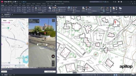
    ๐Ÿ”ต New command to connect to Google Street View*. ๐ŸŽฅ Watch video
    ๐Ÿ”ต Automatic grade generation has been optimized, with increased speed and better adjustment according to restrictions
    ๐Ÿ”ต When calculating volume by surface difference, layer settings can be saved and retrieved
    ๐Ÿ”ต In stakeout point analysis, points can now be projected onto a longitudinal profile

    You can review the complete list of features in the change history document.

    *The number of accesses is limited (see the license agreement for details).

    Availability

    This update is exclusively available to users with an active maintenance contract, who can download it directly from the Client Area.

    Don’t have tcpMDT 25 yet?

    ๐Ÿ†• New users: You can request a quotation from the following page: New tcpMDT 25 Users

    ๐Ÿ” Users with older licenses: If you are already a tcpMDT customer, you can submit the form on this page to upgrade to version 25: Upgrade to tcpMDT 25

    We also recommend managing these processes through our authorized distributors, which you can find on the following page: Find an official Aplitop distributor.

  • Aplitop Achieves an NPS Score of 83

    Aplitop Achieves an NPS Score of 83

    At Aplitop, one of our core values is customer focus, as the user is at the heart of everything we do. That’s why we strive to provide intuitive solutions, an open workflow, an interoperable ecosystem, and personalized technical support.

    Listening to our customers is the best way to improve. This is where the Net Promoter Score (NPS) comes in.

    It starts with a simple question:

    “How likely are you to recommend Aplitop to a friend?”

    Each customer responds on a scale from 0 to 10, and based on their score, they are classified into three groups:
    ๐ŸŸข Promoters (9-10): customers who enthusiastically recommend us.
    ๐ŸŸก Passives (7-8): satisfied, but not likely to recommend.
    ๐Ÿ”ด Detractors (0-6): unlikely to recommend us.

    The NPS is calculated by subtracting the percentage of detractors from the percentage of promoters. A score above 70 is considered excellent.

    We are proud to share that Aplitop has achieved an NPS of 83, a number that reflects not only our customers’ satisfaction but also the trust we have built with them over time.

    Behind every number are people who trust us, share their ideas, and help us continue improving. To all of you, thank you for sharing your feedback.

    Related Links

    ๐Ÿ”— Discover our customers’ opinions
    ๐Ÿ”— Benefits of a maintenance contract
    ๐Ÿ”— Explore our success stories
    ๐Ÿ”— Contact us

  • tcpMDT for GstarCAD 2026

    tcpMDT for GstarCAD 2026

    We announce the availability of tcpMDT 25 for GstarCAD 2026. The combination of these two tools will help you take your surveying, civil engineering, and construction projects to the next level of productivity.

    What is tcpMDT?

    tcpMDT 25 powers your CAD with modular design and advanced tools. Created to solve everyday civil engineering and surveying challenges, it combines ease of use, accuracy and flexibility, adapting to projects of any scale.

    You can learn more about tcpMDT on the following page: Surveying Projects

    What are the latest features in GstarCAD 2026?

    If you want to see all the changes in detail, click on the following link to access the GstarCAD news section.

    New features and changes in GstarCAD 2026

    If you have any questions about the powerful combination of GstarCAD 2026 and our applications, click here:

    ๐Ÿ”— Contact us

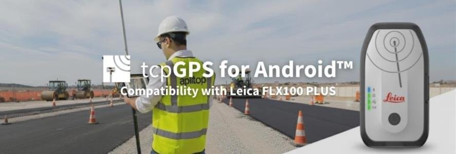
  • tcpGPS for Android: Compatibility with Leica FLX100 PLUS

    tcpGPS for Android: Compatibility with Leica FLX100 PLUS

    What is tcpGPS for Android™?

    tcpGPS is a field application for data acquisition and stakeout of plots, urban areas and infrastructures with GPS/GNSS receivers. It runs on smartphones and tablets with Android operating system.

    Compatibility with Leica FLX100 PLUS

    The application is compatible with Leica equipment, and we have prepared a video showing how to configure the Leica Zeno Connect application to work in tcpGPS with the GNSS receiver tilt compensation function.

    ๐ŸŽฅ Watch video

    What are the other highlights of the latest update?

    ๐Ÿ†• Updated Esri Maps to the latest Android version

    ๐Ÿ†• The last point number is remembered between screens, as an alphanumeric value

    ๐Ÿ†• The NTRIP connection now runs on an Android service

    ๐Ÿ†• Added configuration option to automatically add current date text to a taken photo that has been added to point

    For more information, you can access the change history document.

    Want to know more?

    If you want to learn more about this new version, below, we share links of interest:

    ๐Ÿ”— Request quote for tcpGPS for Android

    ๐Ÿ”— Request demo of tcpGPS for Android

    ๐Ÿ”— Discover the product page of tcpGPS for Android

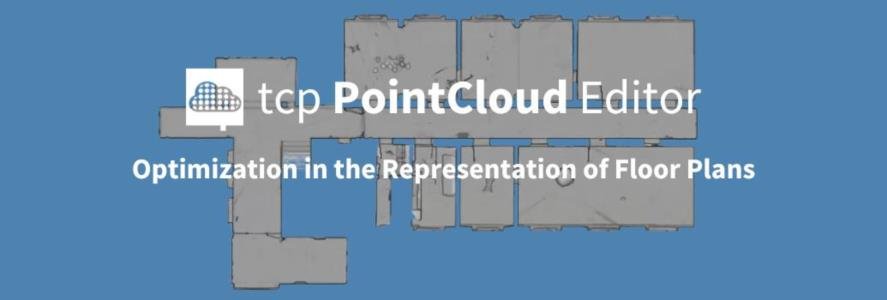
  • tcp PointCloud Editor: Optimization in the Representation of Floor Plans

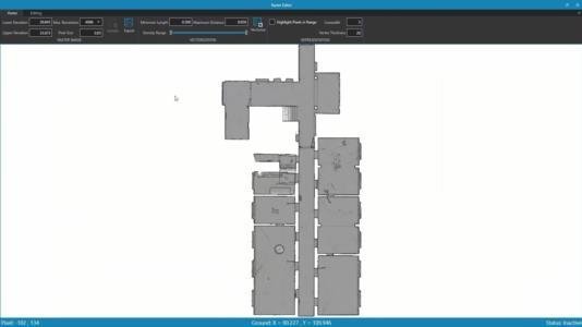
    tcp PointCloud Editor: Optimization in the Representation of Floor Plans

    What is tcp PointCloud Editor?

    tcp PointCloud Editor is an AI-powered point cloud software for surveying, engineering, architecture, and design. It enables 3D modeling and processing point clouds from fixed or SLAM scanners, LiDAR, photogrammetry, and mobile applications.

    What are the latest software updates and enhancements?

    Below, we share a selection of the main new features of tcp PointCloud Editor:

    ๐Ÿ†• Point cloud raster representation in Raster Editor

    ๐Ÿ†• Point cloud properties allow custom codes to be added to captured points

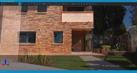
    ๐Ÿ†• Import spherical images and OmniSLAM tours

    ๐Ÿ†• Redesign of point cloud properties dialog

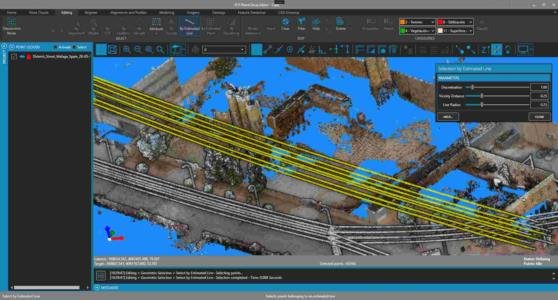
    ๐Ÿ†• Advanced selection of points in point clouds by line/wire

    ๐Ÿ†• Filter points by distance to spherical image in panorama viewer

    For more information, please refer to the change history document.

    Useful links

    ๐Ÿ”— tcp PointCloud Editor Product Page

    ๐Ÿ”— Promotional Video of tcp PointCloud Editor

    ๐Ÿ”— tcp PointCloud Editor Playlist

    ๐Ÿ”— Request a Quote for tcp PointCloud Editor

    ๐Ÿ”— Download the Demo of tcp PointCloud Editor

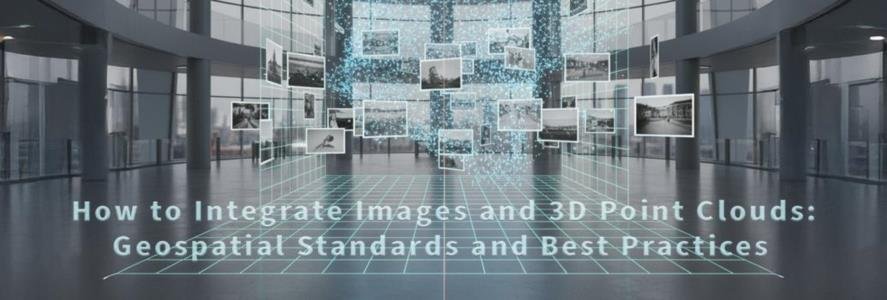
  • How to Integrate Images and 3D Point Clouds: Geospatial Standards and Best Practices

    How to Integrate Images and 3D Point Clouds: Geospatial Standards and Best Practices

    If you prefer, you can read the article in PDF here: How to Integrate Images and 3D Point Clouds: Geospatial Standards and Best Practices 

    By Francisco Navarrete Mandly 

    1. Capture of Point Clouds and Images 

    Three-dimensional data acquisition using 3D laser scanners can be performed with static units or mobile systems based on SLAM (Simultaneous Localization and Mapping) technology.  

    ๐Ÿ”ท Static scanners perform rotational sweeps from a fixed position, generating high-density, high-accuracy point clouds.  

    ๐Ÿ”ท Mobile or SLAM-type scanners acquire data while moving, integrating positioning sensors and real-time mapping algorithms to efficiently generate point clouds. 

    In addition to three-dimensional coordinates, scanners also record the return signal intensity, providing information on the reflective properties of scanned surfaces.  

    To complement this purely geometric and radiometric information, many scanners integrate imaging systems that add visual context to the survey. 

    ๐Ÿ”ท Conventional RGB cameras: Capture images similar to those of a standard digital camera. 

    ๐Ÿ”ท Panoramic or spherical cameras: Use wide-angle or fisheye lenses, or multiple sensors arranged around the unit, to cover a wide field of view. 

    ๐Ÿ”ท Multispectral cameras: Capture bands beyond the visible spectrum, such as near-infrared or ultraviolet, useful for vegetation analysis, heritage conservation, or material inspection. 

    2. Images Generated by Post-Processing Software 

    In addition to processing LiDAR observations, the post-processing software executes a complete photogrammetric workflow that integrates images captured by the scanner's cameras with data from positioning and orientation sensors (GNSS, IMU, etc.).  

    In this process the three-dimensional position and orientation of each image are jointly estimated, solving the external orientation parameters and, unless the camera already has a prior calibration, the internal parameters through self-calibration. If the camera has been previously calibrated, these internal parameters can be fixed and the computation focuses on external orientations. 

    When the system includes multiple cameras, the software stitches and merges the individual images into a common projection, using distortion-corrected images. This ensures continuity of color and geometry so that the images are perfectly aligned with the point clouds for later use in panoramas, orthophotos, or other representations. โ€‹(Crombez et al., 2015; Sharma et al., 2024)โ€‹ 

    The most common types of images generated are: 

    ๐Ÿ”ท Perspective (pinhole or central projection): Represent the classic geometry of a central-lens camera, analogous to a conventional photograph. 

    ๐Ÿ”ท Spherical: Provide a full 360° view of the scene in a continuous spherical projection, ideal for immersive visualization. 

    ๐Ÿ”ท Cylindrical: Project the scene onto a cylindrical surface, particularly useful for panoramic documentation of tunnels, corridors, or long façades. 

    New visualization methods, such as Gaussian Splatting, allow the point cloud to be continuously and realistically represented, generating smooth surfaces with photographic lighting. 

    3. Image Positioning in Space 

    The camera position may be expressed in coordinates of a local reference system or in a global system if the scanner integrates GNSS receivers or if ground control points have been used. 

    Camera orientation is commonly defined by the angles roll, pitch, and yaw: 

    ๐Ÿ”ท Roll: rotation about the camera's longitudinal axis (lateral tilt). 

    ๐Ÿ”ท Pitch: rotation about the transverse axis (tilt up or down). 

    ๐Ÿ”ท Yaw: rotation about the vertical axis (heading left or right). 

    Although intuitive, these angles have limitations: it is not enough to specify their values; the sign convention and the order of the rotations (Euler rotation matrix) must also be defined. Without this information, different software may interpret the same data differently, causing inconsistencies in image orientation.โ€‹(Kim & Kim, 2023)โ€‹ 

    A more robust alternative is the use of quaternions, an extension of complex numbers to four components (qx, qy, qz, qw). Quaternions avoid issues associated with Euler angles, such as sign ambiguity or gimbal lock, and allow stable interpolation of orientations. They are widely used in virtual reality, robotics, and 3D graphics. 

    Beyond accurate position and orientation, it is essential to maintain spatial coherence between point clouds and images so that both coincide exactly within the same reference system. This coherence is especially critical when integrating data in GIS environments or BIM workflows. 

    4. Standard File Formats for Positioning and Orienting Images 

    There are several non-proprietary formats capable of storing images together with their position and orientation parameters. However, not all are suitable for images associated with 3D scanners. 

    EXIF Metadata 

    The Exchangeable Image File format can store complementary data directly within image files, such as capture date, camera used, exposure settings, and even geolocation information using GPS coordinates and camera orientation.  

    However, these metadata have important limitations โ€‹(Acharya R et al., 2023)โ€‹: 

    ๐Ÿ”ท Designed primarily for conventional photography and mobile devices. 

    ๐Ÿ”ท Position is expressed approximately with GPS coordinates, lacking the precision required for surveying applications. 

    ๐Ÿ”ท Orientation is described with basic fields (heading, tilt), insufficient for rigorously representing a camera's 3D pose. 

    ๐Ÿ”ท Cannot adequately represent the position and orientation of oblique images or integrate consistently with point clouds. 

    World Files 

    World files (.jgw, .pgw, .tfw, etc.) are text files associated with a raster image that define its location in a coordinate system through translation, resolution, and rotation parameters.  

    They are widely used in GIS to georeference orthophotos or aerial images in plan view, but they are not suitable for scanner images because: 

    ๐Ÿ”ท Their structure only defines a 2D affine transformation. 

    ๐Ÿ”ท They do not include 3D orientation information. 

    ๐Ÿ”ท They are not designed for oblique or 360° images. 

    Text Files with Camera Parameters 

    A common practice in photogrammetry is to use text files listing the position and orientation of each image, expressed as rotation angles or quaternions. These files are flexible but not standardized.  

    Interpretation criteria can vary between applications: 

    ๐Ÿ”ท Units may be in meters, centimeters, or even pixels. 

    ๐Ÿ”ท Angles may be in degrees or radians, and the reference system may change. 

    ๐Ÿ”ท The order of rotations and angle sign conventions are not always clearly documented. 

    Therefore, despite containing all the data needed to align images and point clouds, their lack of standardization complicates interoperability between applications. 

    E57 

    The ASTM E57 standard is specifically designed for exchanging 3D laser scanning data and is the most comprehensive option for jointly storing point clouds and imagesโ€‹ (Huber, 2011)โ€‹. Its structure allows integrating into a single file not only the scan geometry but also the images from each station and all parameters required to position them accurately in space. 

    E57 supports various image types, from perspective (pinhole or central projection) to spherical or cylindrical panoramas, and explicitly defines the data for their position and orientation.  

    As an open and well-documented format, it facilitates interoperability among different manufacturers and applications, reducing the risk of information loss and ensuring that images can be viewed aligned with point clouds. The open-source library libE57 is a key resource, greatly simplifying the work of developers who need to implement compatibility with this format in their applications, avoiding the need to build E57 reading and writing from scratch. 

    Despite its advantages, E57 also presents certain limitations: 

    ๐Ÿ”ท Files can become very large when numerous high-resolution images are included, slowing read/write and transfer operations. 

    ๐Ÿ”ท It is not designed for multispectral images, such as those containing multiple spectral bands (infrared, ultraviolet, etc.). 

    ๐Ÿ”ท It lacks detailed support for higher-order lens distortion or very specific camera models. 

    ๐Ÿ”ท It does not natively support time sequences or video, so complementary files or proprietary extensions are required for such data. 

    These limitations do not detract from the value of E57 as a reference standard, but they should be kept in mind in projects with a large volume of images or with advanced photogrammetric requirements. 

    5. Conclusions 

    Due to its capabilities and open nature, the E57 format stands out as the best practice for professional exchange of laser scanning data accompanied by georeferenced images.  

    Manufacturers of 3D scanners are encouraged to natively export both point clouds and images in this format, ensuring that each photograph correctly includes its position and orientation parameters. This approach enhances cross-platform interoperability, improves geometric accuracy, and streamlines workflows in engineering, architecture, and construction projects. 

    It is also advisable to follow the evolution of the IFC standard, whose version 5 is expected to advance the integration of BIM and GIS environments. This convergence will enable building and infrastructure information models to be directly linked with geospatial data and with point clouds and images captured in the field, reinforcing information continuity throughout the project lifecycle. 
     
    Finally, adoption of E57 should not be limited to hardware manufacturers: it is equally important that software developers implement full and rigorous compatibility, ensuring interoperability at the application level and fostering an open ecosystem across the geospatial sector. 

    Bibliography 

    โ€‹โ€‹๐Ÿ”— Acharya R, S., J, S., S, S., S Aithal, V., & G S, H. (2023). GEO-LOCATING AN IMAGE USING EXIF DATA. International Journal of Engineering Applied Sciences and Technology, 8(1). https://doi.org/10.33564/ijeast.2023.v08i01.007 

    ๐Ÿ”— โ€‹Crombez, N., Caron, G., & Mouaddib, E. (2015). 3D point cloud model colorization by dense registration of digital images. International Archives of the Photogrammetry, Remote Sensing and Spatial Information Sciences – ISPRS Archives, 40(5W4). https://doi.org/10.5194/isprsarchives-XL-5-W4-123-2015 

    โ€‹๐Ÿ”— Huber, D. (2011). The ASTM E57 file format for 3D imaging data exchange. Three-Dimensional Imaging, Interaction, and Measurement, 7864. https://doi.org/10.1117/12.876555 

    โ€‹๐Ÿ”— Kim, S., & Kim, M. (2023). Rotation Representations and Their Conversions. IEEE Access, 11. https://doi.org/10.1109/ACCESS.2023.3237864 

    โ€‹๐Ÿ”— Sharma, S. K., Jain, K., & Shukla, A. K. (2024). 3D point cloud reconstruction using panoramic images. Applied Geomatics, 16(3), 575–592. https://doi.org/10.1007/s12518-024-00563-w