Category: Uncategorized

  • tcpMDT for progeCAD

    tcpMDT for progeCAD

    What is tcpMDT?

    Aplitop's TcpMDT is a comprehensive software program designed for professionals in surveying and civil engineering. This tool enables users to perform a variety of tasks, from modeling small plots of land to designing larger projects, including extensive housing developments and photovoltaic plants.

    What is progeCAD?

    progeCAD is a permanently licensed CAD alternative that enables you to create, edit, and print DWG and DXF files. Developed by progeSOFT, it provides advanced 2D and 3D design tools at a significantly lower cost compared to other CAD programs available in the market. Some notable features include PDF to DWG conversion, the ability to import and export multiple file formats, and integration with BIM models. Additionally, progeCAD boasts an intuitive and user-friendly interface, making it easy for new users to get started. The software also includes an AEC architecture module and advanced block functionality, offering features like dynamic blocks.

    What to expect from the combination of tcpMDT and progeCAD?

    This software offers an economical solution for professionals who need a permanently licensed CAD program with an intuitive interface for creating, editing, and printing files. When combined with tcpMDT, users can access enhanced features, including the ability to generate digital terrain models, create contour lines, and obtain longitudinal and transverse profiles. Additionally, the software allows for the calculation of excavation and backfill volumes and provides 3D visualizations of terrain. It also facilitates the design of horizontal and vertical alignments, the definition of cross-sections, and the creation of utility networks, such as water, sewer, and stormwater systems.

    Availability

    This new option is currently under development. Once it is in production, all users with active maintenance contracts and those purchasing new licenses will have access to it.

    Links of Interest

    ๐Ÿ”— tcpMDT product page

    ๐Ÿ”— Product page progeCAD

  • Partnership with Stonex

    Partnership with Stonex

    Aplitop is excited to announce its new collaboration with Stonex, a global leader in geospatial measurement and 3D scanning technologies. This partnership represents a significant step forward in providing innovative solutions to the geospatial and engineering communities.

    Through this collaboration, Aplitop’s Tcp PointCloud Editor has been seamlessly integrated with data from Stonex SLAM scanners, ensuring compatibility and improved workflows. Users can now process data from Stonex devices after processing with GOpost, followed by advanced editing and deliverable creation using Tcp PointCloud Editor.

    Key features of this integration:

    – Support for X120GO trajectory and half-panoramas

    – Compatibility with E57 format, including panoramas

    – Tools for managing geotags and editing related metadata

    This partnership underscores Aplitop's commitment to providing cutting-edge software solutions tailored to the needs of architects, engineers, surveyors, designers and other professionals working with geospatial data.

    ๐Ÿ”— tcp PointCloud Editor product’s page

    ๐Ÿ”— New Partnership with aplitop

  • Upcoming release of tcpMDT 25

    Upcoming release of tcpMDT 25

    From Aplitop, we are pleased to announce that we will soon launch a new version of TcpMDT, our most complete solution for surveying civil engineering and construction projects. This update includes several features and improvements designed to optimize and facilitate your work.

    Discover the new features that will transform your projects

    TcpMDT includes more than 100 new features and improvements based on the needs and suggestions of our large user community. Here we highlight some of them:

    ๐Ÿ†• New project management panel

    ๐Ÿ†• Integration with data from TcpGPS and Tcp PointCloud Editor

    ๐Ÿ†• Working with multiple surfaces and 3D face rendering

    ๐Ÿ†• Creation of surfaces and meshes from LAS/LAZ files and point clouds

    ๐Ÿ†• New GIS menu

    ๐Ÿ†• New Shadow, Roughness and Visibility maps

    ๐Ÿ†• Multiple improvements in profiles, volumes, road sections, etc.

    You can also find more information in the TcpMDT news document.

    Availability

    This new version will be available for all users with a current maintenance contract from January 2025, the day of its release, and for new MDT V9 acquisitions from 04/12/2024. If you wish to upgrade your license, we invite you to contact us or your trusted distributor.

    Maintenance Benefits

    โœ… Regular updates: Access to the latest software versions and enhancements.

    โœ… Priority technical support: Specialized technical assistance to solve any doubt or problem.

    โœ… Priority attention for suggestions: Priority evaluation of user suggestions for future enhancements.

    Useful links

    ๐Ÿ”— TcpMDT Product Page

    ๐Ÿ”— Maintenance Benefits

  • tcpMDT PV: New Tracker Calculation Options

    tcpMDT PV: New Tracker Calculation Options

    What is tcpMDT Photovoltaic?

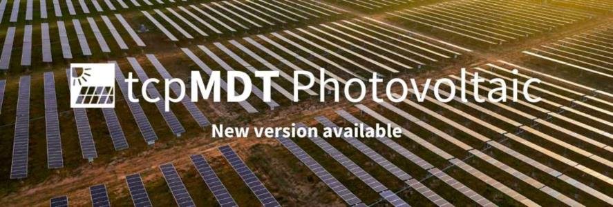
    TcpMDT PV is software that runs as a complement to CAD applications, allowing the minimization of land movement, measurement realization, and staking out of solar trackers. True to its philosophy, Aplitop offers this tool to monetize the most complex land and assist in the design of photovoltaic plants.

    In addition, it facilitates decision-making at a crucial stage: the optimization and accurate calculation of earthworks.

    Highlighted features

    ๐Ÿ†• New options for calculating trackers.

    ๐Ÿ†• New list of constraints

    ๐Ÿ†• Automatic minimization of the jump between trackers.

    ๐Ÿ†• Decomposition of longitudinal slope constraint into North-South and South-North.

    You can learn about the rest of the new features and changes in the change history document.

    Want to learn more?

    If you want to learn more about this new version, below, we share a series of links of interest:

    ๐Ÿ”— Request TcpMDT PV quotation

    ๐Ÿ”— Request a demo of TcpMDT PV

    ๐Ÿ”— Discover the TcpMDT PV page

  • Private Client Area

    Private Client Area

    We are pleased to announce that the Private Client Area is now available for Aplitop customers.

    What are the outstanding features?

    โ–ถ Check active licenses: Easily view, check maintenance and download software updates.

    โ–ถ View support tickets: Open, review, update or create new support requests.

    โ–ถ Control devices: Control and manage the devices you are logged on to.

    ๐Ÿ”— Video – Private Client Area Demostration

    This area is exclusively for customers who have Aplitop applications. Stay tuned to our channels for future information on this topic.

  • TcpMDT for BricsCADยฎ V25

    TcpMDT for BricsCADยฎ V25

    What is TcpMDT?

    Aplitop's TcpMDT is a comprehensive software designed for professionals in the field of surveying and civil engineering. This program allows you to perform a wide range of tasks, from the modeling of a small plot of land to the design of more ambitious projects such as large urbanizations, photovoltaic plants, etc.

    With TcpMDT, users can generate digital terrain models (DTMs), create contour lines, obtain longitudinal and transverse profiles, calculate excavation and backfill volumes, and visualize the terrain in 3D. In addition, the software facilitates the design of horizontal and vertical alignments, the definition of cross-sections, and the creation of utility networks such as water, sewage, and stormwater.

    What's new in BricsCAD® V25?

    BricsCAD® V25 has included new functionalities to automate workflows, along with an easy-to-use design space. Combine both tools to get the most out of your surveying, civil engineering, and construction projects.

    Availability

    This new option is available in the TcpMDT installation for all users with current maintenance contracts and newly purchased licenses.

    Links of interest

    ๐Ÿ”— TcpMDT Product Page

    ๐Ÿ”— Download TcpMDT Demo

    ๐Ÿ”— What's New in BricsCAD 25

  • Compatibility with Leica LGSx Files in tcp PointCloud Editor

    Compatibility with Leica LGSx Files in tcp PointCloud Editor

    From Aplitop, we are happy to inform about a new feature included in our point cloud management software Tcp PointCloud Editor that will bring added value to Leica Geosystems users, the compatibility with LGSx files.

    In fact, we are currently one of the first worldwide to have implemented integration. In the following sections, we show you in detail how you can start using it in your projects today.

    Efficient Import of Point Clouds and Panoramic Images

    Support for Leica LGSx files in Tcp PointCloud Editor allows users to efficiently import point clouds and panoramic images. This format, developed by Leica Geosystems, is widely used in 3D data capture, making it easy to integrate detailed and accurate information into your projects.

    Once imported, panoramic images in LGSx format can be viewed directly in Tcp PointCloud Editor. This functionality is especially useful for measuring and drawing on the images, allowing intuitive and accurate interaction with the visual data.

    How to Import LGSx Files into tcp PointCloud Editor?

    To import LGSx files into tcp PointCloud Editor, follow these steps:

    1. Start tcp PointCloud Editor.

    2. Go to the Point Clouds tab and click on the Import button.

    3. In the file selection window select LGSx.

    4. You can also import panoramic images and associate them with the point cloud from the Images tab, Import from LGSx.

    5. Once the import is finished, the project panel displays the list of images and the associated positions on the 3D viewer.

    6. Clicking on one of these positions opens the panoramic image viewer in which we can work simultaneously with the image and the point cloud, performing measurements, drawings, etc.

    You can see the process in the following video: tcp PointCloud Editor | File Management LGSx

    Support for Leica LGSx files in tcp PointCloud Editor offers a robust solution for managing and editing point clouds and panoramic images. This functionality not only improves the accuracy and efficiency of your projects, but also facilitates a more integrated and versatile workflow.

    Links of interest:

    ๐Ÿ”— tcp PointCloud Editor: Tools for Drawing and Measuring on Images and Point Clouds

    ๐Ÿ”— tcp PointCloud Editor Promotional Video

    ๐Ÿ”— tcp PointCloud Editor Playlist

    ๐Ÿ”— Reality Capture SDK Leica Geosystems

    ๐Ÿ”— Product Page of tcp PointCloud Editor

  • Tcp PointCloud Editor: Tools for Drawing and Measuring on Images and Point Clouds

    Tcp PointCloud Editor: Tools for Drawing and Measuring on Images and Point Clouds

    What is Tcp PointCloud Editor?

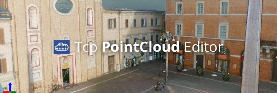
    Tcp PointCloud Editor is an easy-to-use software for visualizing, editing, and managing point clouds captured by scanners, drones, and other technologies. It streamlines surveying, engineering, and architectural projects.

    What are the latest features?

    ๐Ÿ†• Import images from E57 files ๐Ÿ‘‰ Video

    ๐Ÿ†• Drawing and measuring in the image viewer ๐Ÿ‘‰ Video

    ๐Ÿ†• Import points, images and geotags from Leica Geosystems LGSx files ๐Ÿ‘‰ Video

    ๐Ÿ†• Management of geotags ๐Ÿ‘‰ Video

    For more information, you can access the change history document.

    Useful links

    ๐Ÿ”— Tcp PointCloud Editor Product Page

    ๐Ÿ”— Promotional Video of Tcp PointCloud Editor

    ๐Ÿ”— Tcp PointCloud Editor Playlist

    ๐Ÿ”— Request a Quote for Tcp PointCloud Editor

    ๐Ÿ”— Download the Demo of Tcp PointCloud Editor

  • Top 5 Major Pain Points in Managing Point Cloud Data

    Top 5 Major Pain Points in Managing Point Cloud Data

    As software developers, we are always looking for solutions that meet the real needs of professionals, and the main purpose of this article is to understand the challenges of working with point cloud data and how our software can help you overcome them.

    While point cloud data is incredibly valuable to various industries (land surveying, construction, civil engineering, interior design, planning, etc.), it presents several challenges in its management and use.

    Here are five major pain points organizations often encounter when working with point cloud data:

    1. Overwhelming data volume

    Point cloud datasets are notoriously large, often reaching dozens or even hundreds of gigabytes in size.

    This massive volume of data creates numerous issues:

    – Processing Limitations: Standard computers often lack the processing power to handle point cloud data efficiently, leading to slow performance and frequent crashes

    – Transfer Difficulties: Sharing and transferring these enormous files becomes time-consuming and bandwidth-intensive.

    2. Complexity in Data Classification

    Point cloud data typically comes unclassified, making it challenging to extract meaningful information

    This leads to several issues:

    – Time-Consuming Manual Classification: Surveyors and engineers must spend significant time manually classifying points like surfaces, vegetation, buildings, or other features.

    – Inconsistent Classification: Different team members may classify points differently, leading to inconsistencies in the final output.

    – Limited Automated Solutions: While machine learning algorithms for automatic classification are improving, they're still not reliable enough for many applications.

    3. Software and Hardware Limitations

    Working with point cloud data often requires specialized software and hardware, which can be problematic:

    – Expensive Software: Point cloud processing software can be extremely costly, putting it out of reach for smaller organizations

    – Steep Learning Curve: These specialized tools often have a steep learning curve, requiring significant training and expertise.

    – Hardware Requirements: Processing point cloud data demands high-performance computers with powerful GPUs, adding to the overall cost

    4. Data Integration Challenges

    Integrating point cloud data with other data types and existing workflows can be difficult:

    – Incompatibility Issues: Point cloud data may not easily integrate with traditional CAD or GIS software.

    – Workflow Disruption: Incorporating point cloud data often requires significant changes to established workflows.

    – Data Silos: The unique nature of point cloud data can lead to it being isolated from other data sources, hindering comprehensive analysis.

    5. Accuracy and Quality Control

    Ensuring the accuracy and quality of point cloud data presents its own set of challenges:

    – Data Noise: Point clouds often contain noise or irrelevant data points that need to be filtered out

    – Accuracy Verification: Verifying the accuracy of millions or billions of points is a complex and time-consuming process.

    – Data Gaps: Occlusions during data capture can lead to gaps in the point cloud, requiring additional processing or recapture.

    How can Tcp PointCloud Editor help you deal with these challenges?

    Our Tcp PointCloud Editor software is a cost-effective and powerful alternative to deal with all these pain points, providing:

    1. Web Viewer

    Your projects can be published to the cloud and inspected with a web viewer from any device. Also, points, models, alignments, and drawings can be exported to 3D PDF and video. Additionally, you can incorporate breaklines to recover lost information and edit models to correct areas with noise or add missing information.

    2. Management of points and images

    Manage point cloud data obtained from SLAM and LiDAR scanners, mobile apps, drones, or photogrammetry technologies. You can also measure, dimension, and draw easily with intuitive CAD tools such as AutoCAD®, BricsCAD®, GstarCAD®, or ZWCAD®.

    The visualization is optimized, making it easy to analyze the point cloud data, including displaying property captures with histograms, etc. Then you can share results with the final client using the web viewer.

    3. Filtering and editing

    Save time in data classification thanks to the editing and assign categories feature that allows you to select points and hide the rest, for example, points that belong to vegetation or streetlights. You can quickly and visually verify the classification through the color-coded representation of the points. Additionally, there are several ways to select points for classification correction, such as visual selection or using a quick profile view. We’re also working on AI classification features to enhance this process.

    4. Affordability and User-Friendliness

    The application is user-friendly and cost-effective, making it accessible to users of all skill levels. Additionally, there are several learning resources available, such as our training videos for all their needs: Tcp PointCloud Editor – Training Playlist.

    5. Create digital models, calculate profiles and volumes

    With Point Cloud, you can create a surface or mesh and generate contour lines. The symbology of models can be based on their elevations, slopes, orientations, and shading of our orthophotos. Meshes can be edited interactively or apply smoothing, peak, removal, etc. You can also import, and export surfaces and meshes, as well as 3D models in various formats.

    The application has tools to import alignments in LandXML and IFC format and calculate a quick profile from the point clouds model. It is also possible to obtain a longitudinal profile and cross-sections along an alignment and draw 3D polylines on the profile. Top view sections are especially useful for BIM projects. This ensures that model management, BIM, and profiles are integrated. Additionally, it supports CAD drawing and connection with external CAD tools.

    Useful resources

    If you want to learn more about Tcp PointCloud Editor, you can download the trial version here or read some educational information to fully understand our solution:

    ๐Ÿ”— Tcp PointCloud Editor Video

    ๐Ÿ”— Tcp PointCloud Editor Playlist

    ๐Ÿ”— Tcp PointCloud Editor Datasheet

    ๐Ÿ”— Tcp PointCloud Editor Product Page
  • TcpGPS for Android compatible with ROLAVI

    TcpGPS for Android compatible with ROLAVI

    The Aplitop team is pleased to announce our collaboration with the Peruvian company ROLAVI, which specializes in the development of GNSS receivers and offers reliable and precise solutions in industries such as agriculture, construction, surveying, and more.

    We have worked together from Spain and Peru so that professionals can now get the most out of combining our field surveying application TcpGPS for Android™ with their versatile receivers.

    This is another example of our commitment to innovation. We are very grateful to the team and look forward to working with them in the future.

    To learn more about this collaboration, we invite you to explore the links below:

    ๐Ÿ‘‰ TcpGPS for Android™ Product Page

    ๐Ÿ‘‰ TcpGPS for Android™ with ROLAVI Promotional Video

    ๐Ÿ‘‰ ROLAVI Oficial Website